
A new global shorelines and islands resource has been produced by Roger Sayre of the U. S. Geological Survey, in collaboration with colleagues from Esri and a group of coastal ecosystem specialists. Dr. Sayre is the GEO Ecosystems Initiative lead for a Global Ecosystem Mapping activity which has been “cross listed” between GEO ECO and GEO BON since GEO began, and previous products included global ecological land units (ELUs), and global ecological marine units (EMUs). The work to produce the new global shorelines and islands data is described in a publication in the Journal of Operational Oceanography called A New 30 Meter Resolution Global Shoreline Vector and Associated Global Islands Database for the Development of Standardized Ecological Coastal Units (https://www.tandfonline.com/doi/full/10.1080/1755876X.2018.1529714). Several MBON-affiliated scientists (Sayre, Mark Costello, Frank Muller-Karger, and Maria Kavanaugh) are included as co-authors. All of the global ecological unit mapping activity to date, including the new delineation of global islands, is intended to support the characterization of the Ecosystem Extent EBV in the Ecosystem Structure EBV Class.
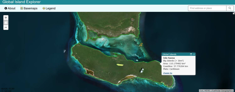
The new global shoreline vector was extracted from 2014 annual composite Landsat imagery. It was developed as the spatial backbone for the development of standardized, robust, and practical global ecological coastal units (ECUs), and the ECU development work is currently underway. The new 30 m global islands data are available in the public domain and will be included in Esri’s Living Atlas resources as well. As a window into the data, an online visualization and query tool, called the Global Island Explorer was developed and is accessible at https://rmgsc.cr.usgs.gov/gie/. The Global Island Explorer tool allows the user to explore the 5 Continental Mainlands, ~22,000 Big Islands (> 1 km2), and ~320,000 Small Islands (< 1 km2). The Global Island Explorer was launched at the Earth Observation for Ecosystem Accounting (EO4EA) Side Event during the GEO Plenary 2018 in October in Kyoto, Japan.
For more information contact Roger Sayre, Land Change Science Program, USGS. rsayre@usgs.gov