
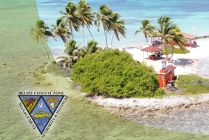
 The GEO BON-supported AI for the Belize National Marine Habitat Map (NMHM) project focuses on updating Belize’s existing Landsat-based two-decade old NMHM using recent, higher spatial and temporal resolution satellite imagery, updated mapping techniques, and leveraging the power of Microsoft’s Azure. In late 2020, the project held a stakeholder workshop to launch the project in Belize and gather information for integration and collaboration. Additionally, as part of the GEO BON Project, the CZMAI (Coastal Zone Management Authority &Institute) team, leading the project, conducted a ground truthing activity within the Belize Central Region for the key habitat classes which included coral, seagrass and mangrove. The team visited several locations that will be used to contribute to the validation and accuracy assessment of the project’s outputs (Figure 1). The GEO BON-supported AI for the Belize National Marine Habitat Map (NMHM) project focuses on updating Belize’s existing Landsat-based two-decade old NMHM using recent, higher spatial and temporal resolution satellite imagery, updated mapping techniques, and leveraging the power of Microsoft’s Azure. In late 2020, the project held a stakeholder workshop to launch the project in Belize and gather information for integration and collaboration. Additionally, as part of the GEO BON Project, the CZMAI (Coastal Zone Management Authority &Institute) team, leading the project, conducted a ground truthing activity within the Belize Central Region for the key habitat classes which included coral, seagrass and mangrove. The team visited several locations that will be used to contribute to the validation and accuracy assessment of the project’s outputs (Figure 1). |
| The project is also gearing up for a summer 2021 follow-up training workshop and presentation of preliminary outputs. Focusing on the major marine habitat types of Belize’s territorial sea, over a hundred individual supervised image classifications based on 10m Copernicus Sentinel-2 data (Figure 2) have been generated. The next phase of this study will include validation of the project outputs via formal accuracy assessment, and expert evaluation. Related to the policy relevance of GEO BON and its goals, the Coastal Zone Management Authority & Institute – the project’s implementing agency – is also evaluating how to integrate the data into the revision of Belize’s Integrated Coastal Zone Management Plan (2016). | ||
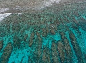 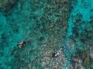 Figure 1. Left: High resolution drone imagery of a coral patch. Right: CZMAI team at the field sites, collecting underwater photography and videos of the corals. |
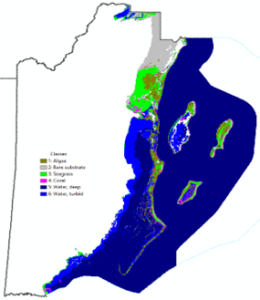 Figure 2. Results of the supervised classification of the Sentinel-2 data with 6 spectral classes (algae-, bare substrate-, seagrass- and coral-dominated habitats, turbid water, and deep water). |
Artificial Intelligence (AI) for the Belize National Marine Habitat Map (NMHM)