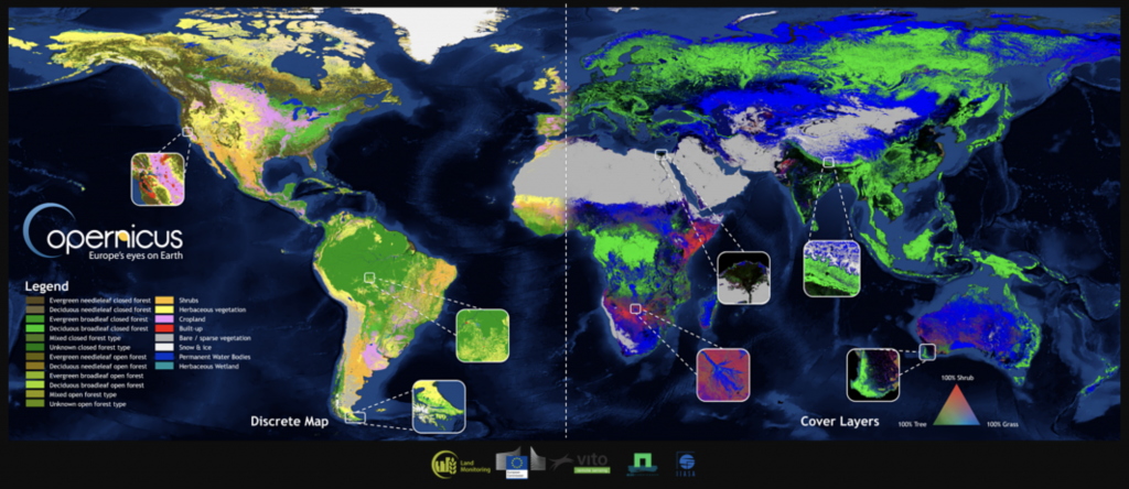
The Copernicus Global Land Service team is thrilled to release a new set of Global Land Cover layers, at 100m resolution and with an overall 80% accuracy. These layers include:
- a complete, discrete classification with 23 classes according to UN-FAO’s LCCS scheme
- versatile fractional cover layers, providing the percentage of ground cover per pixel for the ten base classes: forest, shrub, grass, moss & lichen, bare & sparse vegetation, cropland, built-up / urban, snow & ice, seasonal & permanent inland water bodies.
- a forest type layer offering twelve types of forest
- quality indicators for input data (data density indicator), for the discrete map (probability) and for six of the fractional cover layers.
Head over to our new Global Land Cover viewer, where you can visualize these land cover layers, download the data in 20×20 degree tiles, or compare land cover statistics between countries and regions, all in just a few simple clicks!
Read up in our Land Cover product information and VITO’s blog to learn more about how we scaled up from our Africa demonstration maps to the full globe, thanks to dedicated satellite pre-processing of PROBA-V satellite observations, more training and independent validation points and renowned surface water and settlement footprint datasets.
Or are you more looking forward to our upcoming yearly Land Cover updates?